|
CALM SITE U2 |
BARROW CRREL |
|
Site code |
U2 |
|
Site name |
Barrow |
|
CAPS I Metadata form |
GGD359 |
|
CAPS II Metadata form |
GGD313U_2 |
|
Responsible for data submission |
N. I. Shiklomanov |
|
Email Address |
shiklom”-at-“gwu.edu |
|
Institution/Organization |
GWU |
|
Location description |
Arctic Alaska |
|
Location Lat. |
71 deg. 19 min. N |
|
Location Lon. |
156 deg. 35 min. W |
|
Elevation avg. (m) |
3 |
|
Methods Grid |
1000 |
|
Methods Other |
Air Temperature, Soil temperature, Soil Moisture, Snow
cover |
|
Landscape Description |
Outer coastal plain, drained lake basins |
|
Vegetation /Classification |
Graminoid-moss
tundra (wet and moist acidic) |
|
Soils (or Material) |
Typic
Histoturbel, Typic Aquiturbel (1) |
|
Thaw depth measurements (year started)
|
1962-1966, 1968, 1970, 1991-present |
|
Air temp. measurements (year started) |
1995 |
|
Snow cover measurements (year started) |
1963 |
|
soil
temp. measurements (year started) |
1963 |
|
soil moisture measurements (year started) |
1963 |
|
general description of soil moisture (dry, moist, wet,
saturated) |
Moist to wet |
|
soil texture: if non organic describe texture, if organic
indicate thickness of organic layer (cm) |
Organic Layer thikness:13(cm); mineral texture - silty clay loam/loam/gravelly loam |
|
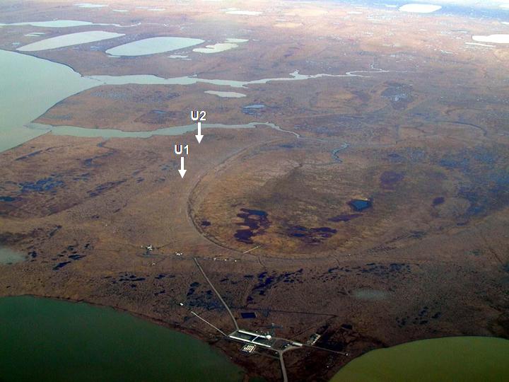
Additional thaw depth and ground temperature data are
available for CALM site U1 located around the U2 Barrow CRREL grid. |
|
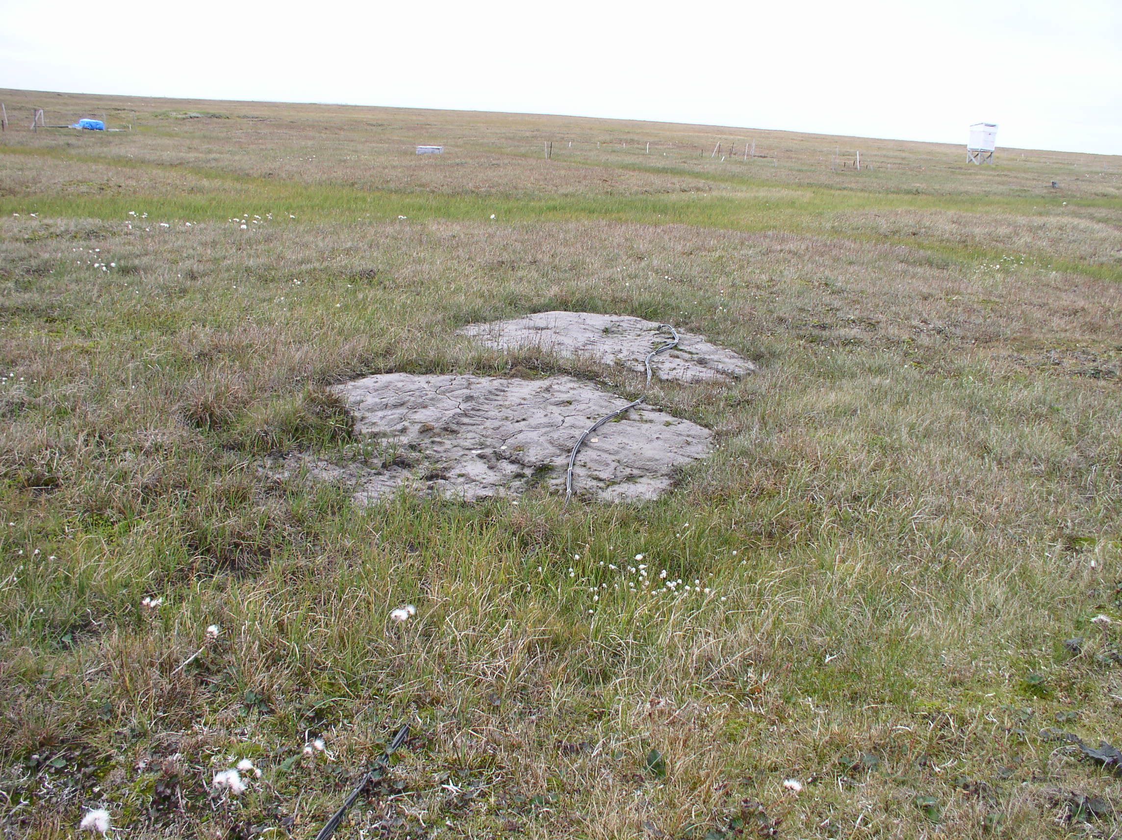
Primary landscape elements: drained lake basin, polygonized upland.
SITE
DESCRIPTION
In 1962, 10 x 10 meter plots
were randomly distributed across a 2-km long transect characteristic of the
ice-wedge dominated Arctic Coastal Plain. Plots were subdivided into 2 x 2 m
squares and the active layer measured at 20 border points during the thaw
season and at all 36 grid points in late August and/or early September. Data
from a total of 42 plots are available at variable sampling intervals, with a
standard set of 20 plots at the end of the thaw season (400 points per sample
date). Summary and descriptive statistics for each plot on each date of
measurement are reported.
Map of plots and further
details on sampling design are provided in USA
CREEL STUDY AREA.doc
Summary statistics by
plot are believed to be accurate reflections of the position of the seasonal
thawing front, owing to the ice-bonded nature of the substrate and the number
of replications at each plot. Values reflecting observations made in late
summer and early fall may be slightly greater than actual (thermally defined)
thaw depth values because some refreezing may have occurred from the bottom of
the active layer.
Soil
temperatures are available from 1963-66, and are located at NSIDC web site http://nsidc.org/data/docs/fgdc/ggd222_activlayer_barrow/data.html
Soil
moisture content data are available from 1963 only and are located at NSIDC web
site http://nsidc.org/data/docs/fgdc/ggd222_activlayer_barrow/data.html
Snow
depth measurements are available from 1963-64, and and
are located at NSIDC web site http://nsidc.org/data/docs/fgdc/ggd222_activlayer_barrow/data.html
These
data were collected at each study plot site to characterize the active soil
layer at Barrow and to determine the relationships these physical properties
have at permafrost sites in the Arctic. Please refer to each subdirectory for
detailed descriptions of the sampling techniques used to collect the data and
the data format for each data set.
For additional soil temperature, soil
moisture, and snow cover data refer to site U1 Barrow 1 km
grid.
The U1
air temperature is in close proximity to CREEL plot 34,
U1-2 soil
temperature, and soil moisture installations are
located in close proximity to CREEL plot 42. The data also available (http://soils.usda.gov/survey/scan/alaska/Barrow2/
)
The environment at Barrow was
described in a series of papers including of the Tundra Biome Program during
the 1970s (Brown et al., 1980). The Barrow CRREL grid is located about 5 km
east of the village of Barrow on the outer Arctic Coastal Plain. The site is
situated on reworked silts of marine origin. A series of nineteen, 10m plots
are located in the southeast section of the 1 km grid (U1).
SOIL DESCRIPTION:
(predominant texture, i.e., ‘sand’, ‘gravel’,
‘peat’, etc.): Ruptic-Histic and Typic Aquiturbels
SAMPLING DESIGN AND METHOD:
Soil thaw was measured by
inserting a metal probe in the soil to the point of resistance. The sample
intervals are varied from year to year. During the summers in 1960s and 1997
outer 20 points of each plot
were probed and at the time of estimated maximum thaw, all 36 plot
points were measured. In years 1993-1996 only interior 16 points were probed.
For map of the study area and sampling design, please check USA CREEL STUDY
AREA.doc
REFERENCES:
Brown,
J. and P.L. Johnson; Pedo-ecological investigation,
Barrow, Alaska. U.S. Army CRREL
Technical Report 159, 1965.
Brown, J., P. L. Miller, L. L. Tieszen, and F. Bunnell (Eds.), An Arctic Ecosystem: The Coastal Tundra at Barrow, Alaska,
John Wiley, New York, 1980.
Brown,
J, K. M. Hinkel, and F. E. Nelson, 2000. The
Circumpolar Active layer Monitoring (CALM) Program: Research Designs
and Initial Results. Polar Geography 24 (3) 165-258
(published in 2002).
Hinkel,
K.M. & Nelson, F.E. 2003. Spatial and temporal patterns of active layer thickness at
Circumpolar Active Layer Monitoring (CALM) sites in northern Alaska, 1995-2000.
Journal of
Geophysical Research, Vol.108, No. D2,
8168.
Soil
temperatures are also available from 1963-66, and are located at NSIDC web site
http://nsidc.org/data/docs/fgdc/ggd222_activlayer_barrow/data.html
Soil
moisture content data are also available from 1963 only and are located at
NSIDC web site http://nsidc.org/data/docs/fgdc/ggd222_activlayer_barrow/data.html
Snow
depth measurements are also available from 1963-64, and are located at NSIDC
web site http://nsidc.org/data/docs/fgdc/ggd222_activlayer_barrow/data.html
For additional soil temperature,
soil moisture, and snow cover data refer to site U1 Barrow 1 km grid.
The U1 air temperature is in
close proximity to CREEL plot 34,
U1-2
soil temperature, and soil moisture installations are
located in close proximity to CREEL plot 42. The data also available (http://soils.usda.gov/survey/scan/alaska/Barrow2/
)