CALM
SITE
Arctic Village |
|
|
Site
Code |
U55 |
|
Site
Name |
Arctic
Village |
|
CAPS
1 Metadata form |
|
|
CAPS
2 Metadata form |
|
|
Responsible
for data submission |
Edda
Mutter |
|
Email
Address |
emutter@yritwc.org |
|
Institution/Organization |
YRITWC |
|
Location
Description |
Alaska Subarctic |
|
Location
Lat. |
N68.13013 |
|
Location
Long. |
W145.54066 |
|
Elevation
avg. (m) |
628 |
|
Methods
Grid |
50 |
|
Methods
Other |
Soil
moisture, soil temp., air temp |
|
Landscape
Description |
flat floodlands near the
river, but is mostly wooded hills |
|
Vegetation/Classification |
Tall grasses, alders, some black spruce |
|
Soils
(or Material) |
Gray/brown silty clay, organic black, decomposing
vegitation |
|
Thaw
depth measurements (year started) |
2010 |
|
Air
temp. measurements (year started) |
2010 |
|
Snow
Cover measurements (year started) |
N/A |
|
Soil
temp. measurements (start year) |
2010 |
|
Soil
moisture measurements (start year) |
2010 |
|
General
description of soil moisture |
Moist-wet |
|
Soil
texture: if non organic describe texture, if organic indicate thickness of
organic layer (cm) |
~12cm vegetation mat ~10cm black organic ~20cm gray silty clay |
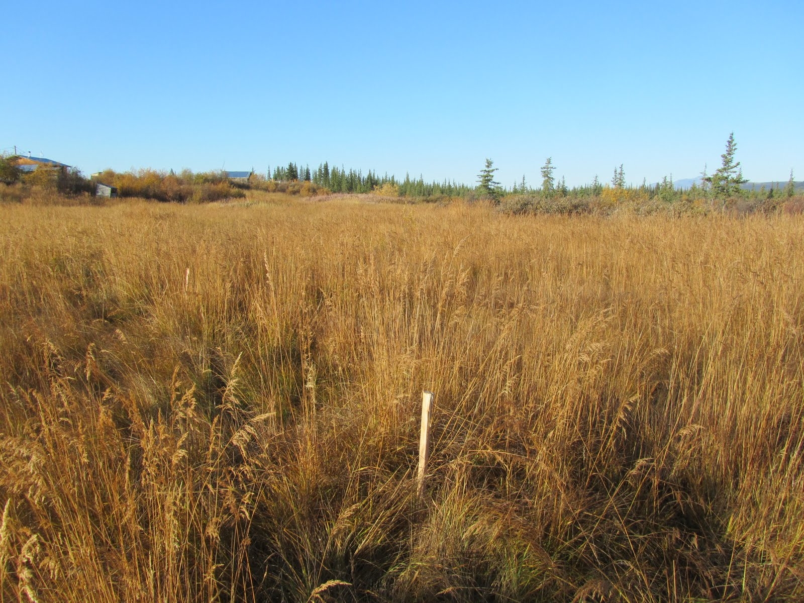
DESCRIPTION OF AREA CONTAINING SITE:
Arctic Village is located on the east fork of the Chandalar River, about 100 miles north of
Fort Yukon and 290 miles north of Fairbanks. Arctic Village is part of the Yukon-
Koyukuk Census Area. The village is in the floodlands
of the river, but surrounded by
rolling hills. The 50m2 grid is located next to the river on the far end of the
“old” village.
The area is open and the ground is tussock with sparse
alders and tall grasses. The
NW corner of the 50mx50m grid is marked by 2 crossed
stakes (by the airplane). Two
parallel lines of stakes placed every 5m are along the ____
and ___ side. The grid
center (N68.13, W145.54) contains continuous soil temperature & soil moisture
sensors
at above permafrost & just below surface levels.
An air temperature sensor is
installed on a tree near grid center (microstation
~5m SE of tree). All sensors collect
and store data on a 30-minute continuous cycle. The grid was established in
2010, with
assistance from the Arctic Village Council, in the second year
of a cooperative
agreement with the Yukon River Inter-Tribal Watershed Council
and the U.S. Geological
Survey.
SOIL DESCRIPTION:
The soil is
characterized by moist dark rich organic soil. A dense clay layer runs just
above the permafrost. Small round pebbles (up to 1/2in
diameter) are in the clay.
SAMPLING DESIGN AND METHOD:
The Nome Creek
site was chosen to increase the range of distribution of Active Layer
Network sites.
The grid
consists of 2 parallel lines of 10 survey stakes at 5-meter intervals, creating
a
50mx50m square grid with a maximum of 100 data points. A compass was
used to
orientate the grid to a square. Active Layer measurements were
taken manually every
5m. The measurements were taken at the lowest surface level
within about 0.3m of the
designated point, to minimize the questionable influence of
tussocks on the AL
measurement. The "surface level" was determined to be
the top of the low-lying
vegetation (i.e. moss, lichen, low-bush berries). Thaw
measurements greater than 1m
were noted, but not used in calculations, as of 2009.
[CALM protocol
suggests a grid size of 100mx100m, however a 50m2 grid
was deemed
acceptable due to difficult terrain and length of time for
installation (personal
communication Dr. V.Romanovsky).]
The soil
climate station was established in early September 2010 and is located near
grid center. The station monitors air temperature, soil temperature & soil
moisture.
The HOBO
micro station was installed at the grid center. A ~30cm4 hole was dug down
to the permafrost layer at 58cm. One set of soil moisture and soil temperature
sensors
were placed just above the permafrost layer and one set just below surface
level. Soil
samples were cut from 56cm and 46cm (cubes) to be analyzed
for soil moisture content.
The HOBO
pro v2 temp/ext temp sensor was installed, recording air temperature, near
the grid center about one meter off the ground surface. The Hobo data logger
is set to
store data on 30min intervals for up to 428 days.
GPS points
were taken at the four corners of the grid, as well as the center point where
the sensors were located. Site elevation is 533m, recorded at grid center.
REFERENCES: