CALM
SITE
Allakaket |
|
|
Site
Code |
U52 |
|
Site
Name |
ALN-AET |
|
CAPS
1 Metadata form |
|
|
CAPS
2 Metadata form |
|
|
Responsible
for data submission |
Edda
Mutter |
|
Email
Address |
emutter@yritwc.org |
|
Institution/Organization |
YRITWC |
|
Location
Description |
Interior-Subarctic |
|
Location
Lat. |
N66.54491 |
|
Location
Long. |
W152.64539 |
|
Elevation
avg. (m) |
135 |
|
Methods
Grid |
50 |
|
Methods
Other |
Soil
moisture, soil temp., air temp |
|
Landscape
Description |
Flat open
area, large tussocks, surrounding hills w/ birch/spruce |
|
Vegetation/Classification |
Grasses,
moss, lichen, large tussocks |
|
Soils
(or Material) |
Organic
black soil, decomposing material, gray silty clay |
|
Thaw
depth measurements (year started) |
2010 |
|
Air
temp. measurements (year started) |
2010 |
|
Snow
Cover measurements (year started) |
N/A |
|
Soil
temp. measurements (start year) |
2010 |
|
Soil
moisture measurements (start year) |
2010 |
|
General
description of soil moisture |
Damp-moist |
|
Soil
texture: if non organic describe texture, if organic indicate thickness of
organic layer (cm) |
~ 24cm
sphagnum moss/lichen mat ~ 24cm
decomposing organic soil ~22cm silty clay |
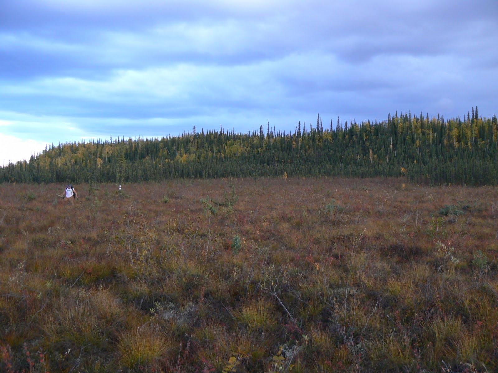
DESCRIPTION OF AREA CONTAINING SITE:
Allakaket is on the south bank of the Koyukuk River, southwest
of its junction with the Alatna River, approximately
190 nautical miles (350 km) northwest of Fairbanks and 57 miles (92 km) upriver
from Hughes. The village of Alatna is located
directly across the river. The 50mx50m grid site is located in the open area
directly behind the Tribal Office. The NW corner of the grid starts about 50yds
diagonally from the SW corner of the building. The area is flat hummocky tundra
with grasses, moss/lichen, small wooded brush (alder)
and 2 stunted black spruce are w/in the grid. The grid, established in 2010, is
marked at 5-meter intervals with surveyor stakes along the North and South
sides of the grid. The grid center (N66.54 W152.64, 20m south of stake 6)
contains continuous soil temperature & soil moisture sensors at “above
permafrost” & “just below surface” levels. An air temperature sensor is
installed on a spruce
tree NE of grid center. All sensors collect and store data on a 30-minute
continuous cycle. The grid was established in 2010, with assistance from Allakaket Traditional Council, in the second year of a
cooperative agreement with the Yukon River Inter-Tribal Watershed Council and
the U.S. Geological Survey.
SOIL DESCRIPTION:
The soil is
characterized by moist dark rich organic soil with partially decomposed plant
matter. The layer above permafrost is a thick gray
silty clay.
SAMPLING DESIGN AND METHOD:
The Allakaket site was chosen to increase the range of
distribution of Active Layer Network sites. Assistance from the Allakaket Traditional Council in land permission and
permafrost laden location was given.
The grid
consists of 2 parallel lines of 10 survey stakes at 5-meter intervals, creating
a 50mx50m square grid with a maximum of 100 data points. A compass was used to
orientate the grid to a square. Active Layer measurements were taken manually
every 5m and recorded on a fieldsheet. The
measurements were taken at the lowest surface level within about 0.3m of the
designated point, to minimize the questionable influence of tussocks on the AL
measurement. The "surface level" was determined to be the top of the
low-lying vegetation (i.e. moss, lichen, low-bush berries). Thaw measurements
greater than 1.3m were noted, but not used in calculations, as of 2009. [CALM
protocol suggests a grid size of 100mx100m, however a 50m2 grid was deemed
acceptable due to difficult terrain and length of time for installation
(personal communication Dr. V.Romanovsky).]
The soil
climate station was established in early September 2010 and is located near
grid center. The station monitors air temperature, soil temperature & soil moisture.The HOBO micro station was installed at the
grid center. A ~30cm hole was dug down to the permafrost layer at 70cm. One set
of soil moisture and soil temperature sensors were placed just above the
permafrost layer and one set just below surface level.
Soil samples
were cut from 67cm and 37cm (cubes) to be analyzed for soil moisture content.
The HOBO pro v2 temp/ext temp sensor was installed, recording air
temperature, near the grid center about one meter off the ground surface. The
Hobo data logger is set to store data on 30min intervals for up to 428 days.
GPS points
were taken at the four corners of the grid, as well as the center point where
the sensors were located. Site elevation is 135m, recorded at grid center.
REFERENCES: