CALM SITECircle |
|
|
Site Code |
U47 |
|
Site Name |
Circle |
|
CAPS 1 Metadata form |
|
|
CAPS 2 Metadata form |
|
|
Responsible for data submission |
Edda Mutter |
|
Email Address |
emutter@yritwc.org |
|
Institution/Organization |
YRITWC |
|
Location Description |
Alaska Subarctic |
|
Location Lat. |
N65.82810 |
|
Location Long. |
W144.07843 |
|
Elevation avg. (m) |
185 |
|
Methods Grid |
50 |
|
Methods Other |
Soil moisture, soil temp., air temp |
|
Landscape Description |
Yukon flats |
|
Vegetation/Classification |
Low brush, berries, black spruce, grasses |
|
Soils (or Material) |
Peat, silty clay |
|
Thaw depth measurements (year started) |
2009 |
|
Air temp. measurements (year started) |
2009 |
|
Snow Cover measurements (year started) |
N/A |
|
Soil temp. measurements (start year) |
2009 |
|
Soil moisture measurements (start year) |
2009 |
|
General description of soil moisture |
moist |
|
Soil texture: if non organic describe texture, if organic indicate thickness of organic layer (cm) |
organic layer thickness ~ 23cm non – 63cm silty clay |
DESCRIPTION OF AREA
CONTAINING SITE:
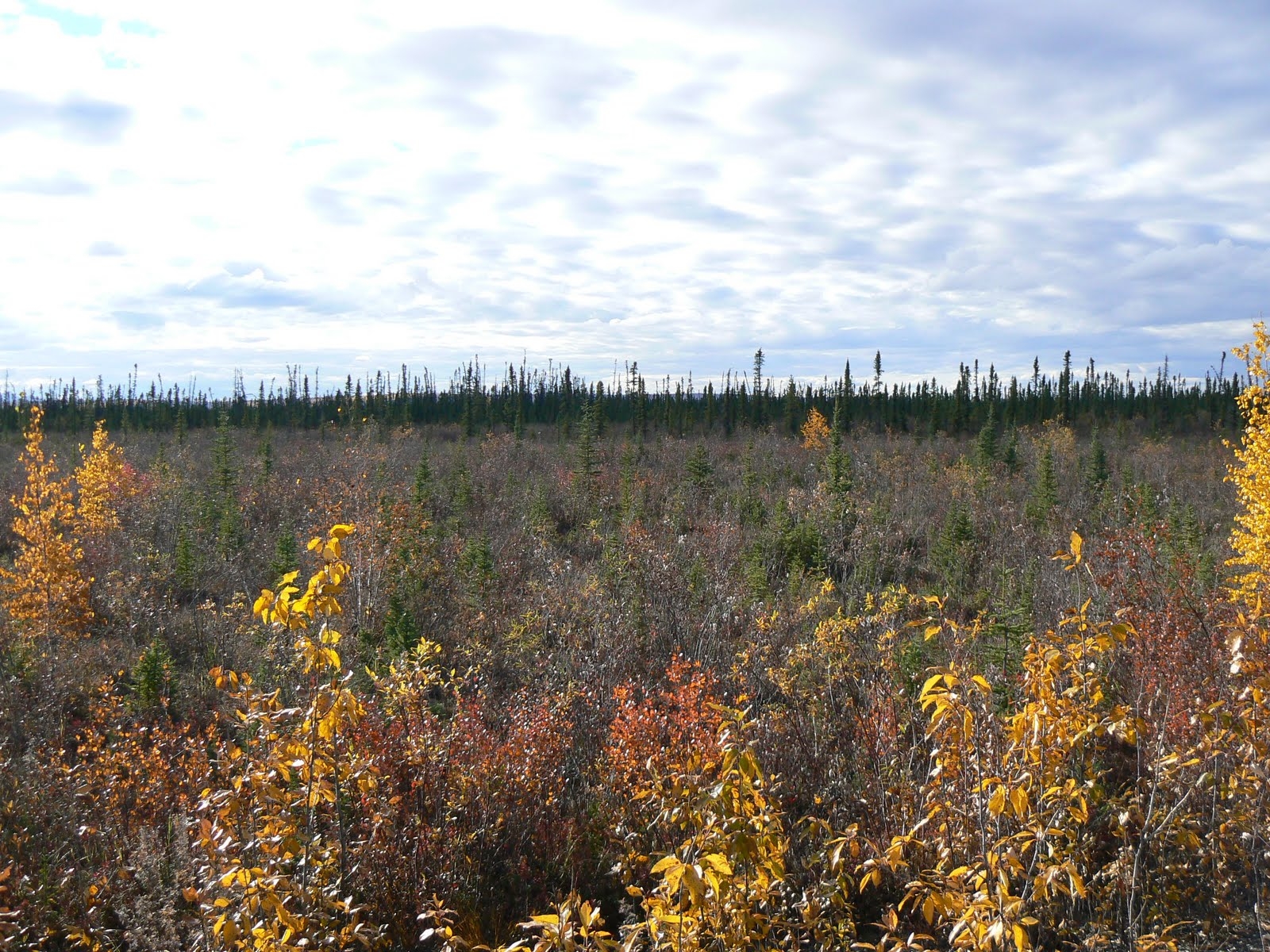
The town of Circle is located on the south bank of the Yukon River at the edge of the Yukon Flats, 160 miles northeast of Fairbanks. It is at the eastern end of the Steese Highway. The 50m2 grid at the Circle site is in an imperfectly drained area of open flat tundra. Low tussocks, low brush, low bush berries and sparsely scattered with black spruce, characterize the vegetation. The 50mx50m grid, established in 2009, is marked with survey stakes at 10m intervals. The grid center (N65.83, W144.08) contains continuous soil temperature & soil moisture sensors at ‘above permafrost’ & ‘just below surface’ levels. An air temperature sensor also records on a 30 min continuous cycle. The grid was established in 2009 through a cooperative agreement with Yukon River Inter-Tribal Watershed Council & the U.S. Geological Survey.
SOIL DESCRIPTION:
Top portion peat, soft clay as depth increases. Soil profile is
5cm sphagnum moss, 6cm organic material, 17cm dark organic, 63cm silty clay.
SAMPLING DESIGN AND
METHOD:
The specific location of the Kotlik site was selected using Traditional Ecological Knowledge of permafrost distribution and depth, followed by on-site ground truthing.
The grid consisted of 50 survey stakes at 10-meter intervals, creating a 50mx50m square grid with a maximum of 100 data points. Active Layer measurements were taken manually every 5m. The measurements were taken at the lowest surface level within about 0.3m of the designated point, to minimize the questionable influence of tussocks on the AL measurement. The "surface level" was determined to be the top of the low-lying vegetation (i.e. moss, lichen, low-bush berries).
[CALM protocol suggests a grid size of 100mx100m, however a 50m2 grid was deemed acceptable due to difficult terrain and length of time for installation (personal communication Dr. V.Romanovsky).]
The soil climate station was established in early September 2009 and is located at grid center. The station monitors air temperature, soil temperature & soil moisture.
The HOBO micro station was installed at the grid center. A ~30cm4 hole was dug down to the permafrost layer at 44cm. One set of soil moisture and soil temperature sensors were placed just above the permafrost layer (91cm) and one set just below surface level. Soil samples were cut from each level (2x2in cubes) to be analyzed for soil moisture content.
The HOBO pro v2 temp/ext temp sensor was installed, recording air temperature, near the grid center about one meter off the ground surface. The Hobo data logger is set to store data on 30min intervals for up to 428 days.
GPS points were taken at the four corners of the grid, as well as the center point where the sensors were located. Site elevation is 185m, recorded at grid center.
REFERENCES: