CALM SITEEmmonak |
|
|
Site Code |
U43 |
|
Site Name |
Emmonak |
|
CAPS 1 Metadata form |
|
|
CAPS 2 Metadata form |
|
|
Responsible for data submission |
Edda Mutter |
|
Email Address |
emutter@yritwc.org |
|
Institution/Organization |
YRITWC |
|
Location Description |
Alaska Subarctic |
|
Location Lat. |
N62.78478 |
|
Location Long. |
W164.52623 |
|
Elevation avg. (m) |
3 |
|
Methods Grid |
50 |
|
Methods Other |
Soil moisture, soil temp., air temp |
|
Landscape Description |
river delta |
|
Vegetation/Classification |
marshy tundra, w/ grassy, moss, low lying willow |
|
Soils (or Material) |
dark peat |
|
Thaw depth measurements (year started) |
2009 |
|
Air temp. measurements (year started) |
2009 |
|
Snow Cover measurements (year started) |
N/A |
|
Soil temp. measurements (start year) |
2009 |
|
Soil moisture measurements (start year) |
2009 |
|
General description of soil moisture |
Moist-wet |
|
Soil texture: if non organic describe texture, if organic indicate thickness of organic layer (cm) |
organic layer thickness ~ 39cm |
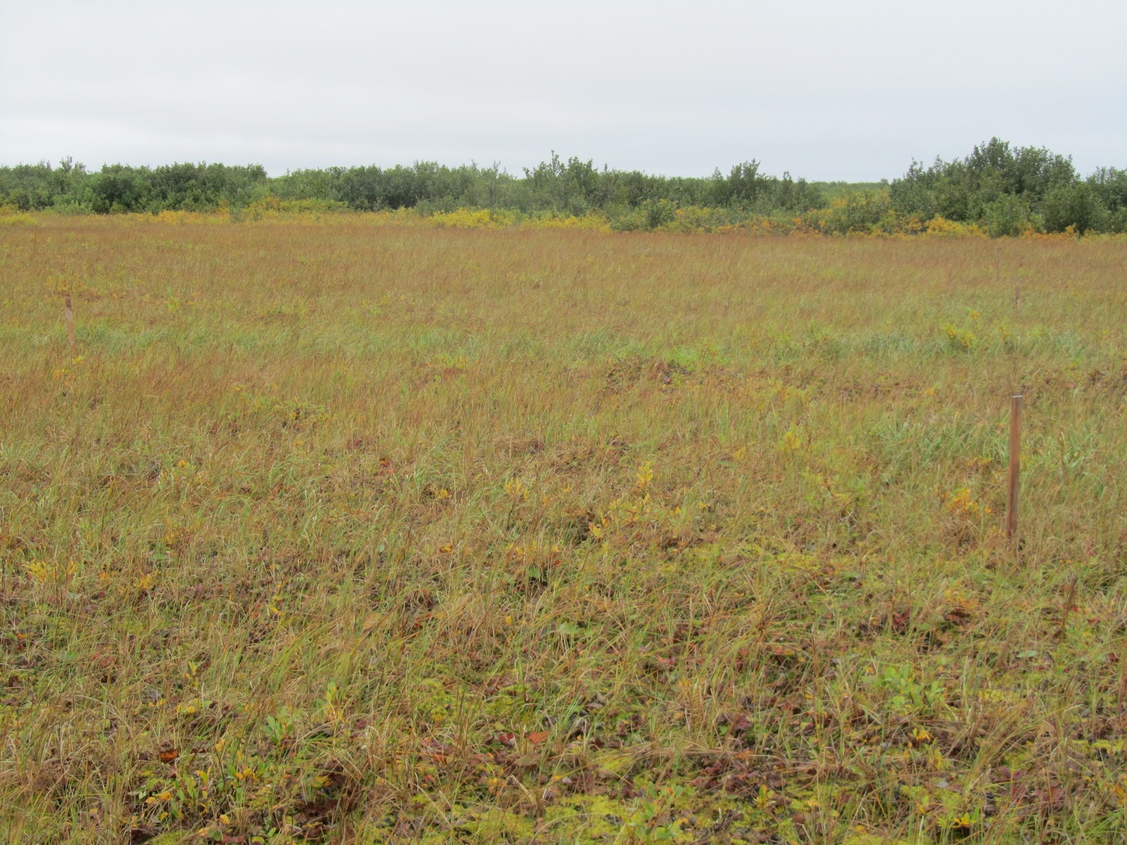
DESCRIPTION OF AREA
CONTAINING SITE:
The Emmonak site is located NW of the town of Emmonak, in the Yukon-Kuskokwim Delta. Taking the boardwalk to the cemetery and heading SW from there will be an open field. The 50m2 grid is in a poorly drained area of open flat marshy tundra, a portion of the NW corner of the grid is very wet, with the AL unable to be determined w/ a 1m probe. Some low willows are also spread sparsely in the NW region of the grid site. The 50mx50m grid, established in 2009, is marked with survey stakes at 10m intervals. The grid center (N62.78, W164.53) contains continuous soil temperature & soil moisture sensors at ‘above permafrost’ & ‘just below surface’ levels. An air temperature sensor also records on a 30 min continuous cycle. The grid was established in 2009 through a cooperative agreement with Yukon River Inter-Tribal Watershed Council & the U.S. Geological Survey, with assistance from Emmonak Traditional Council’s Environmental Coordinator.
SOIL DESCRIPTION:
Predominately characterized by dark peat soil. The soil is non-rocky and poorly
drained. The depth to the water table is
aprox. 30 cm and the impermeable layer is ~49cm. The soil profile is 5cm moss, 5cm roots/rich
soil, 39cm rich dark/black peat.
SAMPLING DESIGN AND
METHOD:
The specific location of the Emmonak site was selected using Traditional Ecological Knowledge of permafrost distribution and depth, followed by on-site ground truthing. It took several attempts to find a suitable grid location with permafrost less than or equal to 1m.
The grid consisted of 50 survey stakes at 10-meter intervals, creating a 50mx50m square grid with a maximum of 100 data points. Active Layer measurements were taken manually every 5m. The measurements were taken at the lowest surface level within about 0.3m of the designated point, to minimize the questionable influence of tussocks on the AL measurement. The "surface level" was determined to be the top of the low-lying vegetation (i.e. moss, lichen, low-bush berries). Thaw measurements greater than 1m were noted, but not used in calculations, as of 2009.
[CALM protocol suggests a grid size of 100mx100m, however a 50m2 grid was deemed acceptable due to difficult terrain and length of time for installation (personal communication Dr. V.Romanovsky).]
The soil climate station was established in early September 2009 and is located at grid center. The station monitors air temperature, soil temperature & soil moisture.
The HOBO micro station was installed at the grid center. A ~30cm2 hole was dug down to the permafrost layer. One set of soil moisture and soil temperature sensors were placed just above the permafrost layer (49cm) and one set just below surface level. Soil samples were cut from each level (2x2in cubes) to be analyzed for soil moisture content.
The HOBO pro v2 temp/ext temp sensor was installed, recording air temperature, near the grid center about one meter off the ground surface. The Hobo data logger is set to store data on 30min intervals for up to 428 days.
GPS points were taken at the four corners of the grid, as well as the center point where the sensors were located. Site elevation is 3m, recorded at grid center.
REFERENCES: