|
CALM SITE U3 |
ATQASUK |
|
Site code |
U3 |
|
Site name |
Atqasuk
|
|
CAPS I Metadata form |
GGD359 |
|
CAPS II Metadata form |
GGD313U_3 |
|
Responsible for data submission |
N. I. Shiklomanov |
|
Email Address |
shiklom”-at-“gwu.edu |
|
Institution/Organization |
GWU |
|
Location description |
Arctic Alaska |
|
Location Lat. |
71 deg. 27 min. N |
|
Location Lon. |
157 deg. 24 min. W |
|
Elevation avg. (m) |
22 |
|
Methods Grid |
1000 |
|
Methods Other |
Air Temperature, Soil temperature, Soil Moisture, Snow
cover |
|
Landscape Description |
Inner
coastal plain, drained lake basins |
|
Vegetation /Classification |
Graminoid, moss tundra tundra
and tussock graminoid, erect-dwarf-shrub (wet and
moist acidic) |
|
Soils (or Material) |
Typic Psammoturbel,
Typic Aquiturbel, Typic Histoturbel (1) |
|
Thaw depth measurements (year started)
|
1995 |
|
Air temp. measurements (year started) |
1996 |
|
Snow cover measurements (year started) |
NA |
|
soil
temp. measurements (year started) |
1996 |
|
soil moisture measurements (year started) |
1996 |
|
general description of soil moisture (dry, moist, wet,
saturated) |
moist to
saturated (on drain lake basin) |
|
soil texture: if non organic describe texture, if organic
indicate thickness of organic layer (cm) |
Organic Layer
thikness:20(cm); mineral texture - silty clay loam |
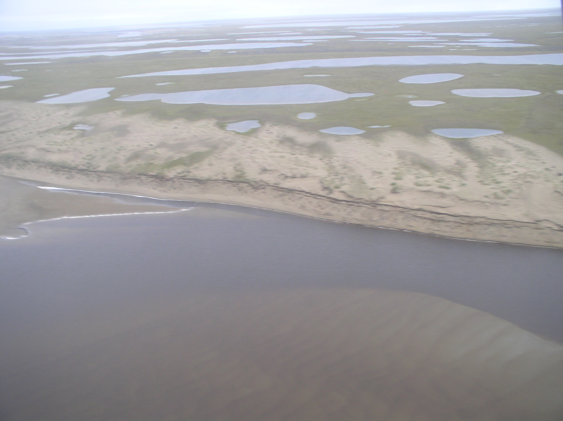
DESCRIPTION OF AREA CONTAINING SITE:
The Atqasuk
site is located along the Meade River on the inner Arctic Coastal Plain,
approximately 100 km inland. The 1-km2 grid is situated on an ancient sand sea
[Everett, 1980; Carter, 1981] developed on a 1% northfacing
slope. A lake occupies a portion of the northeastern quadrant, and the
well-drained sandy higher slopes are characterized by moist acidic tundra. A 1 x 1 km2 grid of precisely surveyed stakes
at 100-m intervals was established at Atqasuk in 1995
under the auspices of the U.S. National Science Foundation’s Arctic
System Science (ARCSS) program. Simultaneous measurement of air and shallow ground
temperature has been operating continuously at the site since 1996 (Hinkel
& Nelson, 2003).
SOIL DESCRIPTION:
(predominant texture, i.e., ‘sand’, ‘gravel’,
‘peat’, etc.): Glacic Psammiturbel,
Typic Histoturbel
SAMPLING DESIGN AND METHOD:
1-sq km grid consists of a square
array of surveyed permanent stakes separated by 100 m, yielding an 11 ×
11 array of sampling nodes on each grid. Thaw depth and snow sampling was
conducted twice by manual probing at each stake. The two values for each
sampling point are averaged, yielding a maximum of 121 data points per grid per
probing date. The active layer was not measured at locations where grid points
intersect rocks or deep water.
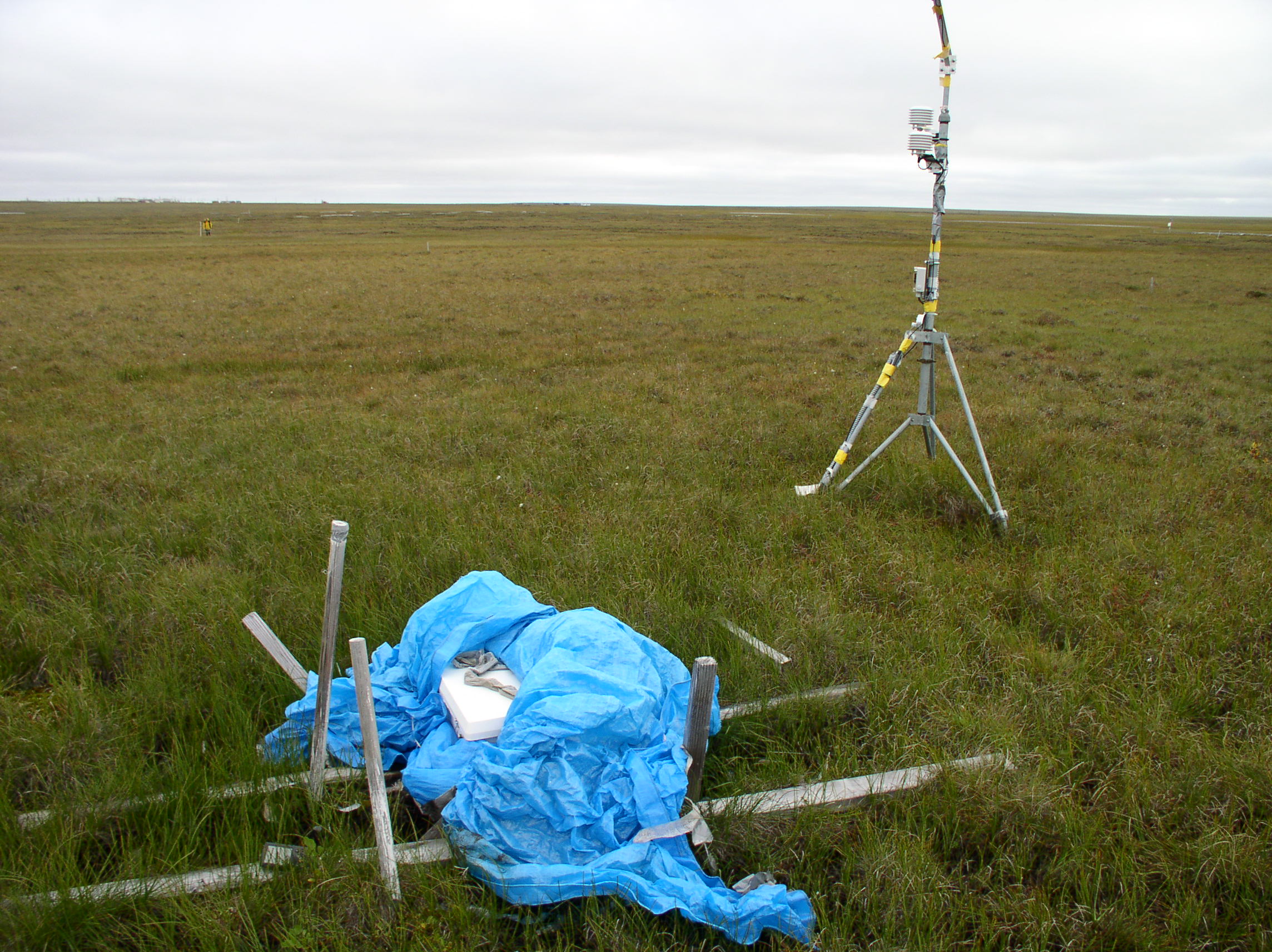
The
soil climate station was established in June of 1996 and is located about 1.5
miles south of the Atqasuk airport runway and within
the CALM U3 grid. The elevation is about 22 m (74 ft). This station monitors
air temperature, soil temperature at various depths to a maximum of 120 cm, and
soil water content at 15, 25, 40, and 50 cm depths. Measurements are made at
20-minute intervals and averaged and recorded every hour.
REFERENCES:
Carter, L. D., A Pleistocene sand
sea on the Alaskan arctic coastal plain, Science, 211, 381– 383,
1981.
Everett, K. R., Distribution and
variability of soils near Atkasook, Alaska, Arct. Alp. Res., 12, 433– 446, 1980.
Hinkel, K.M. & Nelson, F.E. 2003. Spatial
and temporal patterns of active layer thickness at Circumpolar Active Layer
Monitoring (CALM) sites in northern Alaska, 1995-2000.
Journal of Geophysical Research, Vol.108, No. D2, 8168.
Air Temperature, Soil temperature, and Soil moisture
metadata and data are also available at http://soils.usda.gov/survey/scan/alaska/Atqasuk/