|
CALM SITE R44 |
UMBOZERO |
|||||||||||||||||||||||||||||||||||||||
|
Site code |
R44 |
|||||||||||||||||||||||||||||||||||||||
|
Site name |
Umbozero |
|||||||||||||||||||||||||||||||||||||||
|
CAPS I
Metadata form |
|
|||||||||||||||||||||||||||||||||||||||
|
CAPS II
Metadata form |
|
|||||||||||||||||||||||||||||||||||||||
|
Responsible
for data submission |
Dmitri Zamolodchikov |
|||||||||||||||||||||||||||||||||||||||
|
Email
Address |
Dzamolod”-at-“cepl.rssi.ru |
|||||||||||||||||||||||||||||||||||||||
|
Institution/Organization |
Center for
Ecology and Forest Productivity, |
|||||||||||||||||||||||||||||||||||||||
|
Location
description |
|
|||||||||||||||||||||||||||||||||||||||
|
Location
Lat. |
67.7723958 |
|||||||||||||||||||||||||||||||||||||||
|
Location
Lon. |
34.1820458 |
|||||||||||||||||||||||||||||||||||||||
|
Elevation
avg. (m) |
158 |
|||||||||||||||||||||||||||||||||||||||
|
Methods
Grid |
100 |
|||||||||||||||||||||||||||||||||||||||
|
Methods
Other |
|
|||||||||||||||||||||||||||||||||||||||
|
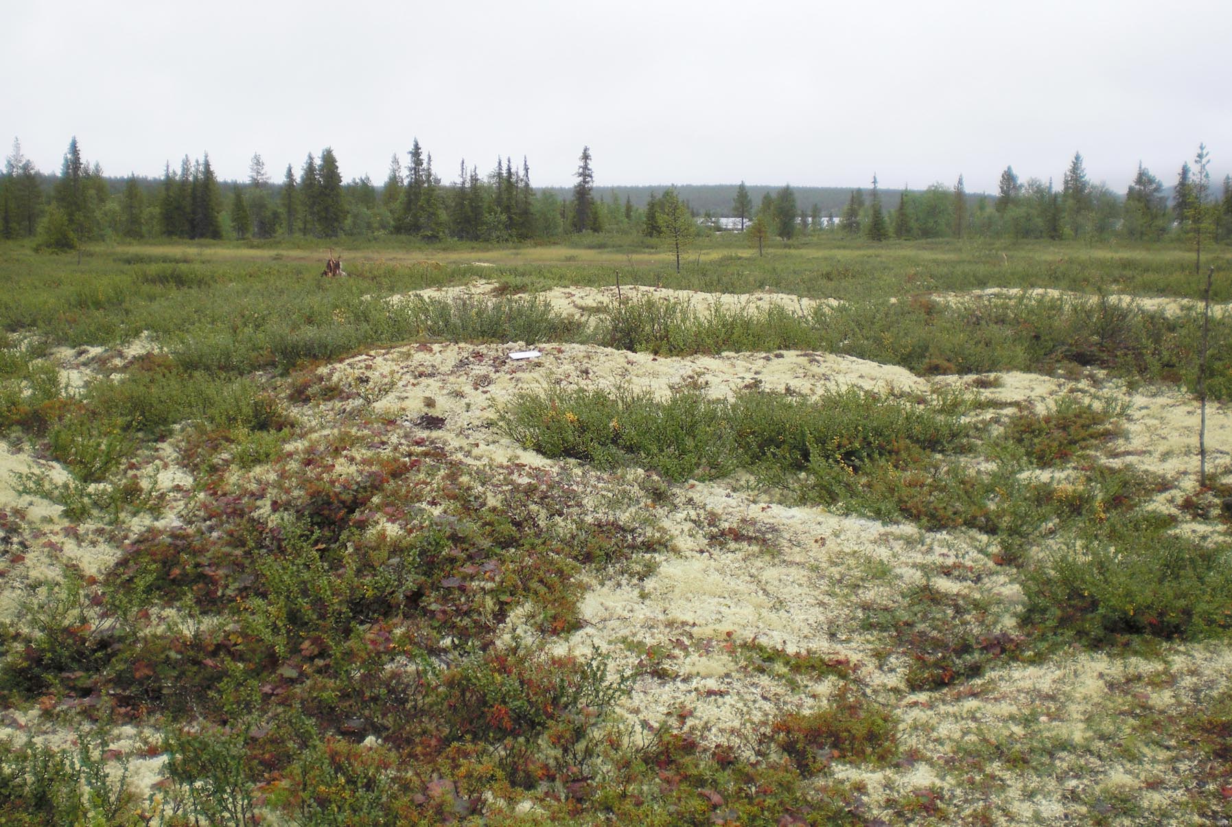
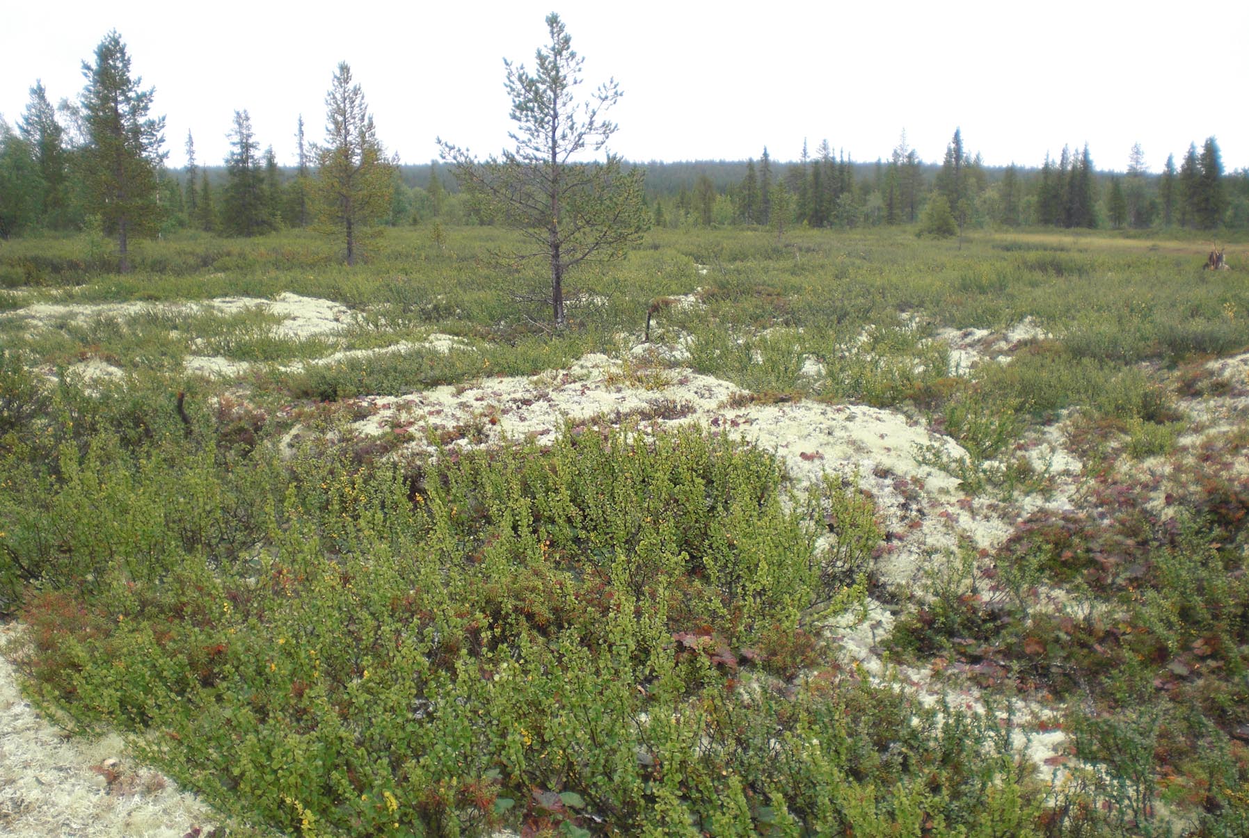
Landscape
Description |
Plain at
the II lacustrine terrace |
|||||||||||||||||||||||||||||||||||||||
|
Vegetation
/Classification |
Boreal
wetland with shrub – dwarf shrub – lichen vegetation, with spruce
open forest with birch and pine undergrowth at 27% of nods. |
|||||||||||||||||||||||||||||||||||||||
|
Soils (or
Material) |
Peat
underlain by sand and gravel |
|||||||||||||||||||||||||||||||||||||||
|
Thaw depth
measurements (year started)
|
2011 |
|||||||||||||||||||||||||||||||||||||||
|
Air temp. measurements
(year started) |
|
|||||||||||||||||||||||||||||||||||||||
|
Snow cover
measurements (year started) |
not planned |
|||||||||||||||||||||||||||||||||||||||
|
soil temp.
measurements (year started) |
2011
(-3.9…24.8 (mean +3.2) °C at |
|||||||||||||||||||||||||||||||||||||||
|
soil moisture
measurements (year started) |
planned |
|||||||||||||||||||||||||||||||||||||||
|
general
description of soil moisture (dry, moist, wet, saturated) |
From moist
to saturated, waterlogged in 7% of nods. |
|||||||||||||||||||||||||||||||||||||||
|
soil
texture: if non organic describe texture, if organic indicate thickness of organic
layer (cm) |
up to |
|||||||||||||||||||||||||||||||||||||||
|
|
|
|||||||||||||||||||||||||||||||||||||||
|
|
||||||||||||||||||||||||||||||||||||||||
|
SITE DESCRIPTION Anchored
and non-anchored permafrost both exist within the site. Monthly temperature
(T) and snow depth data (ds) for Apatity
are shown below in the Table (according to www.rp5.ru weather data):
SOIL
DESCRIPTION:
(predominant texture, i.e., ‘sand’, ‘gravel’,
‘peat’, etc.): Peat, underlain with sand and gravel |
||||||||||||||||||||||||||||||||||||||||
|
|
||||||||||||||||||||||||||||||||||||||||
SAMPLING DESIGN AND METHOD:
1-ha grid
consists of a square array of surveyed permanent stakes separated by
REFERENCES:
Olyunina, O.S., Polyakova, E.I. &
Romanenko, F.A. 2008. Diatom Assemblages from
Holocene Sediments of the