|
CALM SITE R3 |
MARRE SALE |
|
Site code |
R3 |
|
Site name |
Marre
Sale |
|
CAPS I Metadata form |
GGD358 |
|
CAPS II Metadata form |
GGD313_R3 |
|
Responsible for data submission |
Aleksandr Vasiliev |
|
Email Address |
al.a.vasiliev”-at-“gmail.com |
|
Institution/Organization |
Earth Cryosphere Institute SB RAS, Moscow |
|
Location description |
West
Siberia |
|
Location Lat. |
69 deg. 43
min. N |
|
Location Lon. |
66 deg. 51
min. E |
|
Elevation avg. (m) |
18 |
|
Methods Grid |
1000 |
|
Methods Other |
Air Temperature, Soil temperature |
|
Landscape Description |
Marine
plain dissected by lakes and ravines |
|
Vegetation /Classification |
Dry and mesic prostrate dwarf shrub-moss-lichen tundra in
combination with sedge-moss mires |
|
Soils (or Material) |
Dystri-Gelic Gleysols
(sandy) and Fibri-Cryic Histosols
(clayey) |
|
Thaw depth measurements (year started) |
1995 |
|
Air temp. measurements (year started) |
1915 |
|
Snow cover measurements (year started) |
1993 |
|
soil
temp. measurements (year started) |
1996 |
|
soil moisture measurements (year started) |
1996 only |
|
general description of soil moisture (dry, moist, wet,
saturated) |
combination
of dry, moist, and wet tundra |
|
soil texture: if non organic describe texture, if organic
indicate thickness of organic layer (cm) |
sandy-silty |
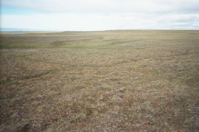
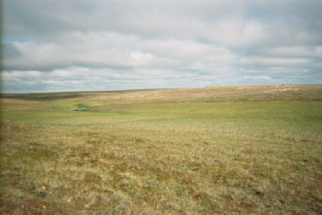
SITE
DESCRIPTION
This site is located on the coast of the Kara Sea near the
polar station Marre-Sale. Measurement of thaw depth
at Marre-Sale has been conducted since 1978, and at
the
associated CALM 1km grid site since 1995.
The 1000 × 1000 m CALM site occupies fluvial-marine terraces with
altitudes ranging from 10 to 25 m. Sandy-silty
deposits prevail in the upper portion of the lithological section. A few
patches of peat, 0.1 to 0.7 m thick, occur atop the section. Well-drained
polygonal tundra, comprised of grasses, moss, lichens, and prostrate dwarf
shrubs, is interspersed with blowout sands and poorly drained sedge-hemiprostrate dwarf shrub lichen-moss tundra at the CALM
site. Sedge-moss mires with peatland fragments are
characteristic of ravines and drained lake depressions. Owing to severe
climatic conditions on the coast of the Kara Sea, the height of dwarf shrubs
does not exceed 15 cm (Melnikov et al, 2004).
SOIL DESCRIPTION:
(predominant texture, i.e., ‘sand’, ‘gravel’,
‘peat’, etc.): Dystri-Gelic
Gleysols (sandy) and Fibri-Cryic
Histosols (clayey)
SAMPLING DESIGN AND METHOD:
1-sq km grid consists of a square
array of surveyed permanent stakes separated by 100 m, yielding an 11 ×
11 array of sampling nodes on each grid. Thaw depth and snow sampling was
conducted twice by manual probing at each stake. The two values for each
sampling point are averaged, yielding a maximum of 121 data points per grid per
probing date. The active layer was not measured at locations where grid points
intersect rocks or deep water.
REFERENCES:
Melnikov, E.S., Leibman,
M.O., Moskalenko, N.G. and Vasiliev,
A.A. 2004. Active-layer monitoring in the cryolithozone
of West Siberia. Polar Geography 28 (4), 267-287
Vasiliev, A.A., Leibman, M.O. & Moskalenko, N.G. 2008. Active layer monitoring in West Siberia under the CALM II program.
Proceedings of the Ninth International
Conference on Permafrost, Fairbanks,Alaska, June
29–July 3, 2008, Vol.2, 1815-1820