|
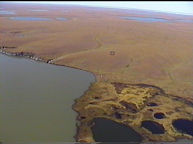
CALM SITE R25 |
YAKUTSKOE LAKE |
|
Site code |
R25 |
|
Site name |
Yakutskoe
Lake |
|
CAPS I Metadata form |
|
|
CAPS II Metadata form |
GGD313_R25 |
|
Responsible for data submission |
Andrey Abramov |
|
Email Address |
pro-forest@mail.ru |
|
Institution/Organization |
Institute
of Physicochemical and Biological Problems in Soil Science Pushchino, Moscow region |
|
Location description |
Lower
Kolyma River |
|
Location Lat. |
69 deg. 51
min. N |
|
Location Lon. |
159 deg. 30
min. E |
|
Elevation avg. (m) |
9 |
|
Methods Grid |
100 |
|
Methods Other |
|
|
Landscape Description |
Edoma with alas depressions |
|
Vegetation /Classification |
Hummocky
tundra |
|
Soils (or Material) |
Gleyic Cryosols |
|
Thaw depth measurements (year started)
|
1996 |
|
Air temp. measurements (year started) |
|
|
Snow cover measurements (year started) |
|
|
soil
temp. measurements (year started) |
|
|
soil moisture measurements (year started) |
1999 |
|
general description of soil moisture (dry, moist, wet,
saturated) |
moist to
wet |
|
soil texture: if non organic describe texture, if organic
indicate thickness of organic layer (cm) |
loamy |
|
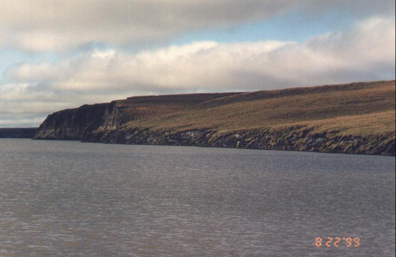
SITE DESCRIPTION Slope of 'Edoma' hill SOIL DESCRIPTION:
(predominant texture, i.e., ‘sand’, ‘gravel’,
‘peat’, etc.): Gleyic
Cryosols |
|
SAMPLING DESIGN AND METHOD:
1-ha grid consists of a square array
of surveyed permanent stakes separated by 10 m, yielding an 11 × 11 array
of sampling nodes on each grid. Thaw depth and snow sampling was conducted
twice by manual probing at each stake. The two values for each sampling point
are averaged, yielding a maximum of 121 data points per grid per probing date.
The active layer was not measured at locations where grid points intersect
rocks or deep water.
REFERENCES:
Fyodorov-Davydov, D.G., Sorokovikov, V.A., Ostroumov,
V.E., Kholodov, A.L., Mitroshin,
I.A., Mergelov, N.S., Davydov,
S.P., Zimov, S.A. & Davydova,
A.I. 2004. Spatial
and Temporal Observations of Seasonal Thaw in the Northern Kolyma Lowland.
Polar Geography 28 (4):
308-325.