|
CALM SITE R24 |
BOLVANSKY |
|
Site code |
R24 |
|
Site name |
Bolvansky |
|
CAPS I Metadata form |
|
|
CAPS II Metadata form |
GGD313_R24 |
|
Responsible for data submission |
Galina Malkova |
|
Email Address |
galina_malk”-at-“mail.ru |
|
Institution/Organization |
Earth Cryosphere Institute SB RAS |
|
Location description |
European
North of Russia |
|
Location Lat. |
68 deg. 18
min. N |
|
Location Lon. |
54 deg. 30
min. E |
|
Elevation avg. (m) |
28 |
|
Methods Grid |
100 |
|
Methods Other |
Air and Soil Temperature |
|
Landscape Description |
Glacial
marine plain dissected by lakes and streams |
|
Vegetation /Classification |
Mesic dwarf shrub-lichen-moss tundra with
frost boils |
|
Soils (or Material) |
Turbi-Histic (Gleyic)
and Gleyi-Turbic Cambisol
(stony loam) |
|
Thaw depth measurements (year started)
|
1999 |
|
Air temp. measurements (year started) |
1999 |
|
Snow cover measurements (year started) |
|
|
soil
temp. measurements (year started) |
1999 |
|
soil moisture measurements (year started) |
1999 |
|
general description of soil moisture (dry, moist, wet, saturated) |
wet |
|
soil texture: if non organic describe texture, if organic
indicate thickness of organic layer (cm) |
loam |
|
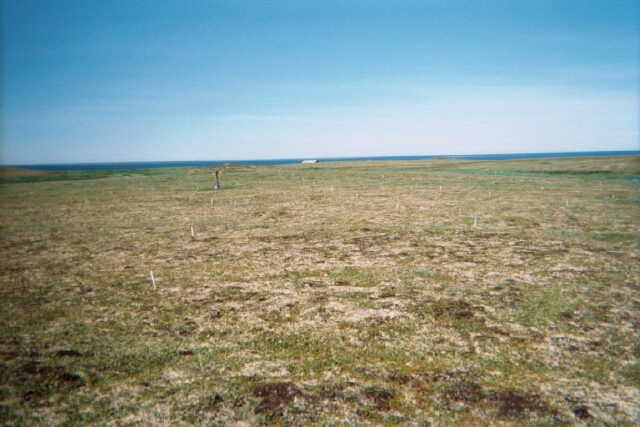
SITE DESCRIPTION The Bolvansky CALM site (68 17.30N; 54 30.00E) is located in
the Pechora River Delta, on the northernmost extremity of Cape Bolvansky, which juts into the Pechora Inlet. The Bolvansky weather station operated on the Cape from 1935
to 1997. Long-term MAAT is 4.4 C and mean annual precipitation is 404 mm. The
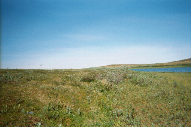
Cape is an undulating plain with numerous lake depressions and large
flat-bottom valleys, some of them with permanent creeks. Elevations range
from 20 to 35m a.s.l. The surficial material is a
boulder sandy loam of Quaternary age exceeding 100m in thickness. Depressions
are occupied by polygonal peatlands and fens with
peat thickness ranging from 0.5 to 5m. The area is geocryologically
unstable due to its position at the western extremity of the continuous
permafrost zone. Permafrost develops under convex and flat surfaces, whereas
the permafrost table is deeper in valleys, both dry and drained by streams.
Data from numerous boreholes show that open taliks
occur under the Pechora valley and beneath many lakes (Ershov,
1988). The Bolvansky grid contains 121 sampling
nodes and occupies the top of a hill with gentle slopes.Dwarf
shrub/lichen tundra with tundra circles (frost boils) occupies the site. The
site contains three boreholes. Permafrost temperature at the depth of zero
annual temperature amplitude (10 to 12 m) is 2.1 C. in a borehole located in
the central and highest point of the site. The range of elevations within the
site is 5m. Organic (peaty) soil layer thickness reaches 22 cm at some grid
nodes, whereas the site average is only 5 cm. Lower soil horizons are
developed in gravelly sandy loam. Volumetric water content of the loam ranges
mostly from 30 to 40%; generally, the thicker an organic layer, the higher
the water content (Mazhitova et al., 2004). SOIL DESCRIPTION:
(predominant texture, i.e., ‘sand’, ‘gravel’,
‘peat’, etc.): Turbi-Histic (Gleyic) and Gleyi-Turbic Cambisol (stony
loam) |
|
SAMPLING DESIGN AND METHOD:
1-ha grid consists of a square array
of surveyed permanent stakes separated by 10 m, yielding an 11 × 11 array
of sampling nodes on each grid. Thaw depth and snow sampling was conducted
twice by manual probing at each stake. The two values for each sampling point
are averaged, yielding a maximum of 121 data points per grid per probing date.
The active layer was not measured at locations where grid points intersect
rocks or deep water.
REFERENCES:
Malkova G.V. 2006. Subsurface ground temperature in the
Russian cryolithozone and recent climatic warming. Global Environmental Change:
Regional Challenges, 9-12 nov.
2006, - Beijing, China - Beijing International Convention
Center. Parallel session 5 "From Climate Research
to Risk Management", P. 33.
http://www.essp.org/ESSP2006/ParallelSessions.htm
Malkova-Ananjeva G.V. 2005. Frozen ground response to recent
climate changes in the
European North. EUCOP
II, 2nd European conference on permafrost,
Potsdam, Germany, 12-16 June 2005. p.137.
Mazhitova G., Malkova (Ananjeva)
G., Chestnykh O., Zamolodchikov
D. 2004. Active-layer
spatial and temporal variability at European Russian
Circumpolar-Active-Layer-Monitoring (CALM) sites. Permafrost and Periglacial Processes,15. P.
123–139.
Pavlov
A.V., Malkova-Ananjeva G.V. 2005. Climate
and Cryolitozone Changes within Russian Oil and Gas Provinces. I CliC
International Science Conference/ 11-15 April, Beijin,
China. 2005, p. 178