|
CALM SITE R23 |
TALNIK |
|
Site code |
R23 |
|
Site name |
Talnik |
|
CAPS I Metadata form |
|
|
CAPS II Metadata form |
GGD313_R23 |
|
Responsible for data submission |
Dmitri Zamolodchikov |
|
Email Address |
dzamolod”-at-“ hotbox.ru |
|
Institution/Organization |
Center for
Ecology and Forest Productivity, Moscow |
|
Location description |
European
North of Russia |
|
Location Lat. |
67 deg. 20
min. N |
|
Location Lon. |
63 deg. 44
min. E |
|
Elevation avg. (m) |
120 |
|
Methods Grid |
100 |
|
Methods Other |
Air and Soil Temperature |
|
Landscape Description |
Glacial marine
plain deposit over shallow bedrock, dissected by streams |
|
Vegetation /Classification |
Mesic shrub-dwarf shrub-moss-lichen
tundra |
|
Soils (or Material) |
Stagnic Cryosol, Stagni-Gelic Cambisol (loamy) |
|
Thaw depth measurements (year started) |
1998 |
|
Air temp. measurements (year started) |
|
|
Snow cover measurements (year started) |
|
|
soil
temp. measurements (year started) |
|
|
soil moisture measurements (year started) |
1999 |
|
general description of soil moisture (dry, moist, wet,
saturated) |
moist |
|
soil texture: if non organic describe texture, if organic
indicate thickness of organic layer (cm) |
organic layer is 4 to 25 cm; silty loam |
|
SITE DESCRIPTION The Talnik CALM site (67 19.80N; 63 44.00E) is located 20 km
south of the town of Vorkuta, near the Talnik
railway station. The distance from the Ayach-Yakha site is 40 km. The site is
located on the same undulating glacial-marine plain as Ayach-Yakha
and occupies a gentle northeast-facing slope. The range of elevations within
the site is 4.7 m, with a distinct ridge and a depression/hollow each
covering approximately one half of the site. The MAPT is not known; however,
it should not be less than 2.0 C according to the most recent permafrost map
of the area
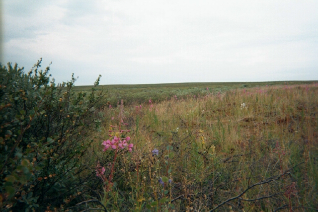
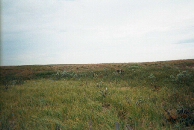
Fifty-seven per cent of the site is covered with a
lichen/feather moss/tall shrub/dwarf shrub community, and the remainder is
occupied by communities dominated by feather mosses and dwarf birch. Willows
in depressions are up to 1.5m high. Moss coverage is more than 70% in
depressions, but less than 30% on a ridge. Soils are loamy Stagnic Cryosols and Stagni-Gelic Cambisols. The
organic layer has not been surveyed across the entire site, but its thickness
in three soil pits varied from 4 to 25 cm. Snow thickness reaches 200 cm in
depressions, and ranges from 40 to 60cm on the ridge. SOIL DESCRIPTION:
(predominant texture, i.e., ‘sand’, ‘gravel’,
‘peat’, etc.): Stagnic
Cryosol, Stagni-Gelic Cambisol (loamy) |
|
SAMPLING DESIGN AND METHOD:
1-ha grid consists of a square array
of surveyed permanent stakes separated by 10 m, yielding an 11 × 11 array
of sampling nodes on each grid. Thaw depth and snow sampling was conducted twice
by manual probing at each stake. The two values for each sampling point are
averaged, yielding a maximum of 121 data points per grid per probing date. The
active layer was not measured at locations where grid points intersect rocks or
deep water.
REFERENCES:
Mazhitova G., Malkova (Ananjeva)
G., Chestnykh O., Zamolodchikov
D. 2004. Active-layer
spatial and temporal variability at European Russian
Circumpolar-Active-Layer-Monitoring (CALM) sites. Permafrost and Periglacial Processes,15. P.
123–139.