|
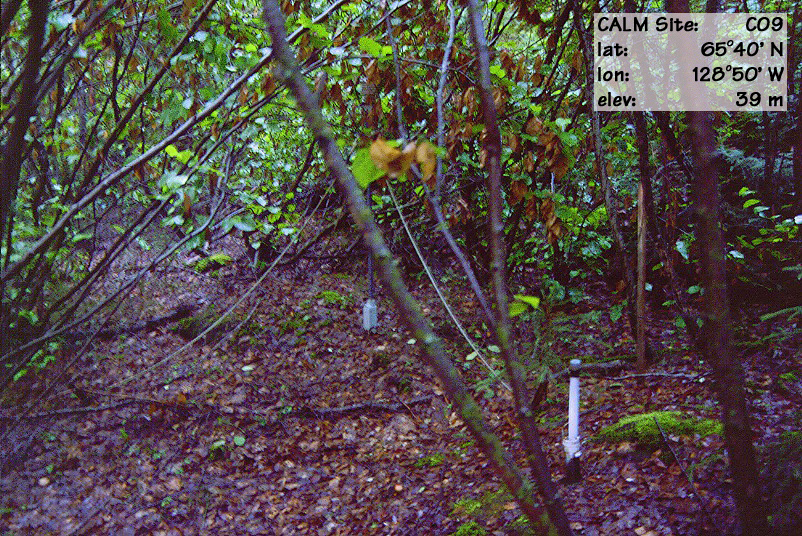
Site code |
C9 |
|
Site name |
Mountain River |
|
CAPS I Metadata form |
GGD353 |
|
CAPS II Metadata form |
GGD313C_9 |
|
Responsible for data submission |
F. Mark Nixon |
|
Email Address |
mnixon@nrcan.gc.ca |
|
Institution/Organization |
Geological Survey of Canada, Ottawa |
|
Location description |
Mackenzie Valley |
|
Location Lat. |
65 deg. 40 min. N |
|
Location Lon. |
128 deg. 50 min. W |
|
Elevation avg. (m) |
39 |
|
Name code |
[3] |
|
Methods Grid |
|
|
Methods Other |
TT |
|
Years of record (a) |
10 |
|
Min Thaw (cm)(b) |
57 |
|
Max Thaw (cm)(b) |
62 |
|
Thawing Degree Days (c) |
1357 |
|
Landscape Description |
Low fluvial terrace |
|
Vegetation /Classification |
Birch-alder thicket |
|
Soils (or Material) |
Orthic Eutric Static Cryosol (2) |
|
soil temp. measurements (year started) |
1993 |
|
soil moisture measurements (year started) |
1998 |
|
general description of soil moisture (dry, moist, wet,
saturated) |
moist |
|
soil texture: if non organic describe texture, if organic
indicate thicknesss of organic layer (cm) |
sand (15 cm) |