|
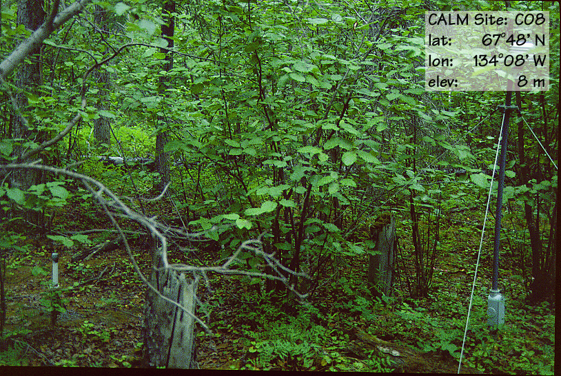
Site code |
C8A |
C8B |
|
Site name |
Rengleng
River (TT) |
Rengleng
River (Grid) |
|
CAPS I Metadata form |
GGD353 |
|
|
CAPS II Metadata form |
GGD313C_8A |
GGD313C_8B |
|
Responsible for data submission |
F. Mark Nixon |
F. Mark Nixon |
|
Email Address |
mnixon@nrcan.gc.ca |
mnixon@nrcan.gc.ca |
|
Institution/Organization |
Geological Survey of Canada, Ottawa |
Geological Survey of Canada, Ottawa |
|
Location description |
Mackenzie Valley |
Mackenzie Valley |
|
Location Lat. |
67 deg. 48 min. N |
67 deg. 48 min. N |
|
Location Lon. |
134 deg. 08 min. W [05'] |
134 deg. 08 min. W [05'] |
|
Elevation avg. (m) |
8 |
9 |
|
Name code |
[3] |
[3] |
|
Methods Grid |
100 |
|
|
Methods Other |
TT |
|
|
Years of record (a) |
10 |
5 |
|
Min Thaw (cm)(b) |
102 |
75 |
|
Max Thaw (cm)(b) |
116 |
82 |
|
Thawing Degree Days (c) |
1075 |
1075 |
|
Landscape Description |
Alluival
plain at delta apex |
|
|
Vegetation /Classification |
Mixed spruce and hardwood |
|
|
Soils (or Material) |
Regsolic
Static Cryosol (2) |
|
|
soil
temp. measurements (year started) |
1994 |
|
|
soil moisture measurements (year started) |
2000 |
2000 |
|
general description of soil moisture (dry, moist, wet,
saturated) |
dry-moist |
moist |
|
soil texture: if non organic describe texture, if organic
indicate thicknesss of organic layer (cm) |
silty
sand |
silty
sand |