|
Site code |
C15A |
C15B |
|
Site name |
Fort Simpson (TT) |
Fort Simpson (Grid) |
|
CAPS I Metadata form |
GGD353 |
|
|
CAPS II Metadata form |
GGD313C_15A |
GGD313C_15B |
|
Responsible for data submission |
F. Mark Nixon |
F. Mark Nixon |
|
Email Address |
mnixon@nrcan.gc.ca |
mnixon@nrcan.gc.ca |
|
Institution/Organization |
Geological Survey of Canada, Ottawa |
Geological Survey of Canada, Ottawa |
|
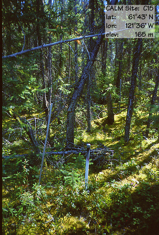
Location description |
Mackenzie Valley |
Mackenzie Valley |
|
Location Lat. |
61 deg. 53 min. N |
61 deg. 53 min. N |
|
Location Lon. |
121 deg. 36 min. W |
121 deg. 36 min. W |
|
Elevation avg. (m) |
165 |
166 |
|
Name code |
[3] |
[3] |
|
Methods Grid |
100 |
|
|
Methods Other |
TT |
|
|
Years of record (a) |
9 |
4 |
|
Min Thaw (cm)(b) |
95 |
69 |
|
Max Thaw (cm)(b) |
>164 |
77 |
|
Thawing Degree Days (c) |
1439 |
1439 |
|
Landscape Description |
Glaciolacustrine
plain |
|
|
Vegetation /Classification |
Mixed spruce-feathermoss |
|
|
Soils (or Material) |
Histic
Eutric Turbic Cryosol (2) |
|
|
soil
temp. measurements (year started) |
1992 |
|
|
soil moisture measurements (year started) |
1998 |
2000 |
|
general description of soil moisture (dry, moist, wet,
saturated) |
moist |
wet-saturated |
|
soil texture: if non organic describe texture, if organic
indicate thicknesss of organic layer (cm) |
sand (25 cm) |
sand (25 cm) |