|
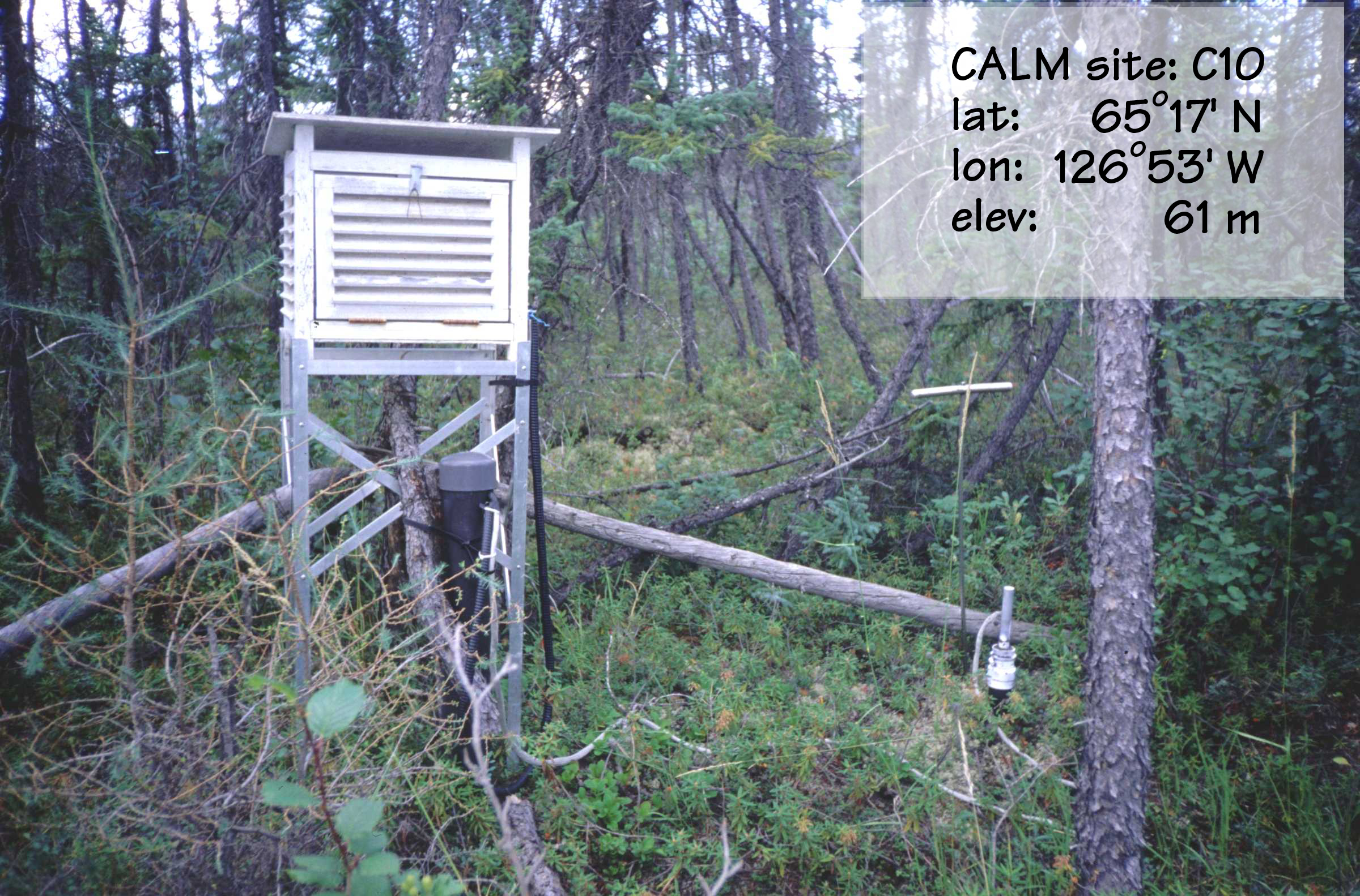
CALM SITE C10 |
PUMP STATION |
|
Site code |
C10 |
|
Site name |
Pump Station |
|
CAPS I Metadata form |
GGD312 |
|
CAPS II Metadata form |
GGD313C_10 |
|
Responsible for data submission |
Charles Tarnocai |
|
Email Address |
tarnocaict@agr.gc.ca |
|
Institution/Organization |
Agriculture and Agri-Food
Canada, Ottawa |
|
Location description |
Mackenzie Valley |
|
Location Lat. |
65 deg. 17 min. N |
|
Location Lon. |
126 deg. 53 min. W |
|
Elevation avg. (m) |
70 |
|
Name code |
[4] |
|
Methods Grid |
|
|
Methods Other |
T/P |
|
Years of record (a) |
16 |
|
Min Thaw (cm)(b) |
40 |
|
Max Thaw (cm)(b) |
87 |
|
Thawing Degree Days (c) |
1438 |
|
Landscape Description |
Lacustrine
plain |
|
Vegetation /Classification |
Open black spruce forest |
|
Soils (or Material) |
Histic
Regosolic Turbic Cryosol (2) |
|
soil
temp. measurements (year started) |
1986 |
|
soil moisture measurements (year started) |
|
|
general description of soil moisture (dry, moist, wet,
saturated) |
moist |
|
soil texture: if non organic describe texture, if organic
indicate thicknesss of organic layer (cm) |
clay loam (38 cm) |
Active-Layer Thickness is inferred
from ground temperature profile measurements at 2.5, 5.0, 10.0, 20.0, 50.0,
100.0 and 120.0 cm depth. The ALT values are presented in summary table. The
dataset also include soil temperature data for 01/01/1989 - 10/09/1996 period.
For details on site description and instrumentation contact site investigator
directly.
Site metadata is provided in C10_meta.doc